
Plik:Nepal rel location map.svg

Rozmiar pierwotny (Plik SVG, nominalnie 1100 × 721 pikseli, rozmiar pliku: 1,86 MB)
Opis
| Opis |
Deutsch: Positionskarte von Nepal
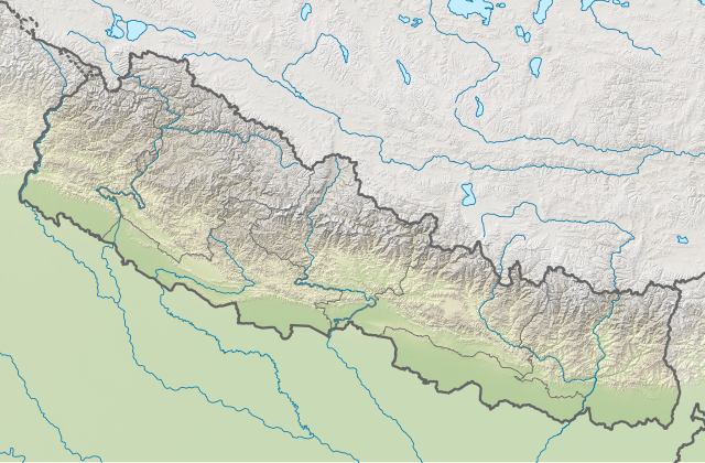
English: Location map of Nepal including the 7 provinces
|
||||||||||||
| Data | |||||||||||||
| Źródło |
Praca własna przy użyciu:
|
||||||||||||
| Autor | NordNordWest | ||||||||||||
| Inne wersje |
|
||||||||||||


|
Ta mapa została stworzona lub ulepszona w niemieckiej Kartenwerkstatt (Pracowni Kartograficznej). I Ty możesz zaproponować inne mapy do ulepszenia.
|
Licencja
Usage of this file with:

explanatory notes: Legally binding is only the full legalcode. For a free usage I recommend to respect the following licence conditions:
1. Provide my name as given above: NordNordWest,
2. a copy of, or the URI for, the applicable license: https://creativecommons.org/licenses/by-sa/3.0/de/legalcode,
3. the title of the work,
4. in the case of an adaptation, a credit identifying the use of the work in the adaptation.
This license and the rights granted hereunder will terminate automatically upon any breach by you of the terms of this license. Any of the above conditions can be waived if you get permission from the copyright holder. If you have questions or wish differing conditions, please contact me through nnwest or my discussion page ![]() t-online.de
t-online.de
- Wolno:
- dzielić się – kopiować, rozpowszechniać, odtwarzać i wykonywać utwór
- modyfikować – tworzyć utwory zależne
- Na następujących warunkach:
- uznanie autorstwa – musisz określić autorstwo utworu, podać link do licencji, a także wskazać czy utwór został zmieniony. Możesz to zrobić w każdy rozsądny sposób, o ile nie będzie to sugerować, że licencjodawca popiera Ciebie lub Twoje użycie utworu.
- na tych samych warunkach – Jeśli zmienia się lub przekształca niniejszy utwór, lub tworzy inny na jego podstawie, można rozpowszechniać powstały w ten sposób nowy utwór tylko na podstawie tej samej lub podobnej licencji.

Historia pliku
Kliknij na datę/czas, aby zobaczyć, jak plik wyglądał w tym czasie.
| Data i czas | Miniatura | Wymiary | Użytkownik | Opis | |
|---|---|---|---|---|---|
| aktualny | 20:00, 2 cze 2020 | | 1100 × 721 (1,86 MB) | NordNordWest | corr |
| 19:14, 22 mar 2020 |  | 1100 × 721 (1,86 MB) | NordNordWest | corr | |
| 18:51, 20 lis 2019 |  | 1100 × 721 (1,86 MB) | NordNordWest | corr | |
| 17:07, 5 cze 2018 |  | 1100 × 721 (1,86 MB) | NordNordWest | == {{int:filedesc}} == {{Information |description= {{de|1=Positionskarte von Nepal}} {{en|1=Location map of Nepal}} {{Location map series N |stretching=114 |top=31.0 |bottom=26.0 |left=79.8 |right=88.5 }} |source={{Own using}} * United States National Imagery and Mapping Agency data * SRTM3 data |date=2018-06-05 |author={{U|NordNordWest}} |permission= |other_versions=<gallery>Nepal adm location map.svg</gallery> }} {{Kartenwerkstatt}} == {{int:license-header}} == {{User:NordNordWest/LicenceM... |
Lokalne wykorzystanie pliku
Następujące strony korzystają z tego pliku:
Globalne wykorzystanie pliku
Ten plik jest wykorzystywany także w innych projektach wiki:
- Wykorzystanie na ab.wikipedia.org
- Wykorzystanie na an.wikipedia.org
- Wykorzystanie na ar.wikipedia.org
- Wykorzystanie na az.wikipedia.org
- Wykorzystanie na ban.wikipedia.org
- Évérést
- Taman Nasional Sagarmatha
- Taman Nasional Banke
- Taman Nasional Langtang
- Taman Nasional Rara
- Taman Nasional Shey Phoksundo
- Taman Nasional Khaptad
- Taman Nasional Bardiya
- Taman Nasional Makalu Barun
- Taman Nasional Shivapuri Nagarjun
- Taman Nasional Shuklaphanta
- Taman Nasional Parsa
- Lebah Kathmandu
- Wykorzystanie na bcl.wikipedia.org
- Wykorzystanie na be.wikipedia.org
Pokaż listę globalnego wykorzystania tego pliku.